SELME Matthieu Auteur photographe panoramiste 360
Home / Sphériques / France


play 360 panoramaDomaine de ski de fond au Pont d'Espagne à Cauterets Le pont d'Espagne est un site naturel des Pyrénées, situé à une altitude de 1500m, à côté du village de Cauterets. C'est un espace protégé, qui fait partie du Parc National des Pyrénées. Ce site était un lieu de passage et d'échange avec l'Espagne. A la fin du XIXe siècle, c'était un lieu prisé par la haute société, puis vers les années 1960, avec le tourisme de masse, le site a été fortement dégradé par la circulation automobile et les touristes ! Depuis 1990, le site fait partie d'un grand projet de réhabilitation : bâtiments sauvages détruits, circulation restreinte et zones naturelles préservées. www.360x180.fr Selme Matthieu

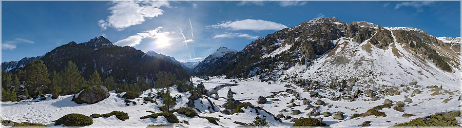
Bridge of Spain is a natural site in the Pyrenees, at an altitude of 1500m, near the village of Cauterets. This is a protected area, which is part of the Pyrenees National Park. This site was a place of passage and exchange with Spain. At the end of the nineteenth century it was a popular place for high society and the 1960s, with mass tourism, the site has been severely degraded by traffic and tourists! Since 1990, the site is part of a large restoration project: Wild buildings destroyed, restricted and preserved natural areas.
   Panorama made of 12 x 3 photos taken on the 31 December 2012.  
Click on the image to view the 360º panorama !   

play 360 panoramaChronopanorama : 3/3 : Lac de Gaube dans les nuages ! Chronopanorama dans les nuages : le Lac de gaube est situé dans une petite vallée, démarrant au pied du Vignemale (3298m), et se terminant au Pont d'Espagne. www.360x180.fr Selme Matthieu

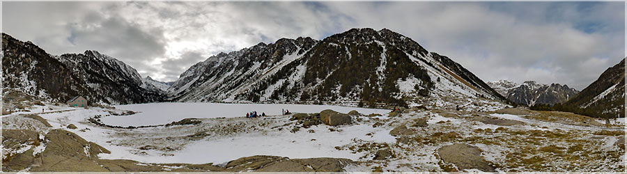
Chronopanorama in the clouds: Lake Gaube is situated in a small valley, starting at the foot of Vignemale (3298m), and ending at the Pont d'Espagne.
   Panorama made of 12 x 3 photos taken on the 02 January 2013.  
Click on the image to view the 360º panorama !   

play 360 panoramaChronopanorama : 2/3 : Lac de Gaube dans la neige ! Chronopanorama sous la neige : Le lac de Gaube se situe à une altitude de 1725m, il se trouve dans la vallée de Gaube. www.360x180.fr Selme Matthieu

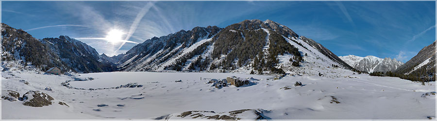
Chronopanorama Beneath the Snow: Lake Gaube is located at an altitude of 1725m, it is in the valley of Gaube.
   Panorama made of 12 x 3 photos taken on the 31 December 2012.  
Click on the image to view the 360º panorama !   

play 360 panoramaChronopanorama : 1/3 : Lac de Gaube après le coucher de soleil Chronopanorama composé de 3 panoramas, pris au même endroit, sur des jours différents. Le premier jour, nous arrivons juste après le coucher de soleil. 'Gaube' veut dire 'lac' en Gascon !  www.360x180.fr Selme Matthieu

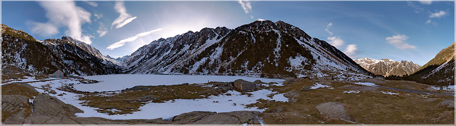
Chronopanorama composed of 3 panoramas taken at the same location on different days. The first day, we arrived just after sunset. 'Gaube' means 'lake' in Gascon!
   Panorama made of 12 x 3 photos taken on the 30 December 2012.  
Click on the image to view the 360º panorama !   

play 360 panoramaCirque de Gavarnie Cirque de Gavarnie en hiver. Après une petite marche dans la neige depuis le parking de Gavarnie, nous arrivons au refuge, fermé en cette saison. Le soleil est bas en hiver, il ne passera pas par dessus les crêtes, c'est dommage !  www.360x180.fr Selme Matthieu

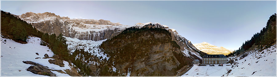
Cirque de Gavarnie in winter. After a short walk through the snow from the parking lot of Gavarnie, we arrive at the shelter closed this season. The sun is low in winter, it will not pass over the ridges, it is a shame!
   Panorama made of 12 x 3 photos taken on the 29 December 2012.  
Click on the image to view the 360º panorama !   


Retour en haut